Postcode Data
The following maps are free to download and use under the ODbL license, more details on this and copyright information can be found in the license section below.
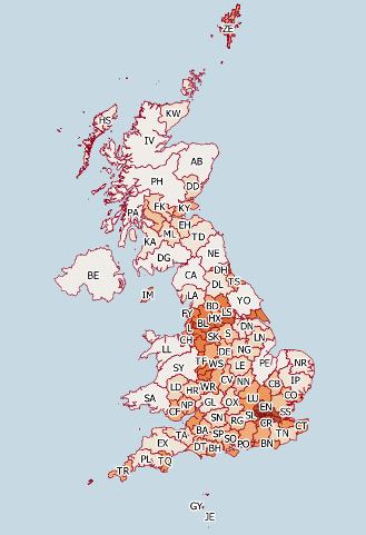
The data are available in Shape file format (shp) and there are maps available for Postcode areas, districts and sectors. The maps present an approximation of these geographies, given that they are generated from postcode points. More details on how the maps are generated can be found on this page.
Downloads
August 2016
Postcode areas pc_area.zip
Postcode districts pc_district.zip
Postcode sectors pc_sector.zip
May 2016
Postcode areas pc_area.zip
Postcode districts pc_district.zip
Postcode sectors pc_sector.zip
February 2016
Postcode areas pc_area.zip
Postcode districts pc_district.zip
Postcode sectors pc_sector.zip
November 2015
Postcode areas pc_area.zip
Postcode districts pc_district.zip
Postcode sectors pc_sector.zip
August 2015
Postcode areas pc_area.zip
Postcode districts pc_district.zip
Postcode sectors pc_sector.zip
May 2015
Postcode areas pc_area.zip
Postcode districts pc_district.zip
Postcode sectors pc_sector.zip
February 2015
Postcode areas pc_area.zip
Postcode districts pc_district.zip
Postcode sectors pc_sector.zip
November 2014
Postcode areas pc_area.zip
Postcode districts pc_district.zip
Postcode sectors pc_sector.zip
License
All Versions
This Gismo Postcode database is made available under the Open Database License: http://opendatacommons.org/licenses/odbl/1.0/. Any rights in individual contents of the database not detailed below are licensed under the Database Contents License: http://opendatacommons.org/licenses/dbcl/1.0/.
Contact us for less restrictive paid license options.
February 2015 - November 2015
Postcodes used to create these files are from the Office for National Statistics and are issued under the following license http://www.nationalarchives.gov.uk/doc/open-government-licence/, Contains National Statistics data © Crown copyright and database right [2015], Contains OS data © Crown copyright and database right [2015], Contains Royal Mail data © Royal Mail copyright and database right [2015]. The BT postcode have not been used as these need a paid for license from http://www.dfpni.gov.uk/lps/index/copyright_licensing_publishing.htm
The Great Britain coastline is from the Ordnance Survey Meridian 2 dataset January 2015 release and is also used under the following license http://www.nationalarchives.gov.uk/doc/open-government-licence/ Contains OS data © Crown copyright and database right [2015].
November 2014
Postcodes used to create these files are from the Office for National Statistics and are issued under the following licenses http://www.nationalarchives.gov.uk/doc/open-government-licence/, Contains National Statistics data © Crown copyright and database right [2014], http://www.ordnancesurvey.co.uk/oswebsite/docs/licences/os-opendata-licence.pdf, Contains Ordnance Survey data © Crown copyright and database right [2014], Contains Royal Mail data © Royal Mail copyright and database right [2014]. The BT postcode have not been used as these need a paid for license from http://www.dfpni.gov.uk/lps/index/copyright_licensing_publishing.htm
The Great Britain coastline is from the Ordnance Survey Meridian 2 dataset and is also © Crown copyright and database right [2014], http://www.ordnancesurvey.co.uk/oswebsite/docs/licences/os-opendata-licence.pdf
All Versions
Ireland, Isle of Man and Channel Islands coastline data from European Environment Agency (EEA) and is used under the EEA standard re-use policy see http://www.eea.europa.eu/data-and-maps/data/eea-coastline-for-analysis#tab-metadata.
The UK/Republic of Ireland border used is from Department of Energy & Climate Change and is used under the Open Government Licence see https://www.gov.uk/oil-and-gas-offshore-maps-and-gis-shapefiles.
Whilst every effort has been made to make these maps as accurate as possible, Gismo Software Limited accepts no responsibility or liability whatsoever for there use.
Postcode Area Map